The Geographical Situation And Discovery Of Rwanda
Rwanda as we find it on the map today lies in the centre of the African continent just south of the equator. Being equidistant from Capetown and Cairo and raughly nine hundred miles from Mombasa on the Indian Ocean and one thousand two hundred miles from Boma on the Atlantic, it had for a very long time escaped the enquiries of the early discoverers. Although Speke arrived at its eastern borders in 1861, he was forcibly prevented from entering. It was only in 1894 that the first European, von Gotzen, entered Rwanda, crossing it from east to west, accompanied by his six hundred and twenty askaris. He met Kigeri Rwabugiri who was on one of his military operations in western Rwanda in Kingogo ofKisenyi district.
Little did this expansive warrior king know that at the Berlin Conference, British, Belgian and German diplomats had decided nearly ten years previously in 1885 that his kingdom was part of the German zone of influence in East Africa and was marked on the maps as district fourteen of the vast area called Deutsch Ost Afrika. It was only in 1900 that the first permanent garrison along the Congo border was established and Rwanda thus militarily occupied in a definite form, having formerly been controlled from the station at Usumbura, in Urundi.
From the early missionary reports it is evident that before civilian occupation took over there were never more than five or six German officers in permanent residence in Rwanda. Although in 1907 civilian administration took over, during the whole period of German rule there were never more than ten Germans stationed in Rwanda. They introduced a system of indirect rule, putting the force of their authority behind the current political hierarchy and
established the boundaries as we now know them. The only changes were made in 1910 when the same diplomats decided that the Kinyarwanda speaking provinces of Gisigari and Jomba and the isle of Idjwi in Lake Kivu were to be given to Kivu, while the northern district of Bufumbira was to be attached to the Uganda Protectorate. In 1919 a large strip was taken from its eastern borders and given to Tanganyika in connection with the plans for the Cape-Cairo route, but this was restored to Rwanda on January,lst 1924. In this way the actual boundaries of Rwanda donot coincide either with the Kinyarwanda speaking peoples or with those territories which in one way or another were part of the zone of influence of the king of Rwanda prior to European intervention.
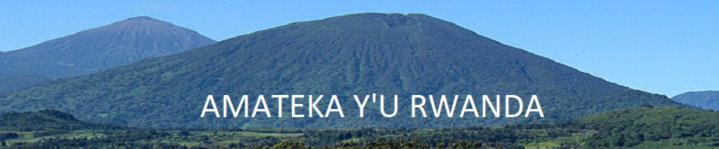
Rwanda as it appears on the maps today covers an area of slightly over ten thousand square miles. But the actual surface area must be considerably larger on account of its extremely hilly terrain. On the north it is bounded by Uganda where the frontier runs through open country. The north-western and western boundaries with the Congo are formed from north to south by the Virungamountains, Lake Kivu and the Rusizi river. The north-west is volcanic, the highest peak being the Karisimbi (fourteen thousand seven hundred and eighty feet). A number of these vo1canoes are still active. Over the last sixty years, apart from a number of smaller eruptions such as those in 1903 and 1905, great natural disasters were caused by the Katerusi in 1912 and the Nyamuragira in 1930. In 1938 a very fertile and densely populated area covering two hundred square miles was destroyed between the volcano and Lake Kivu..
On the south the boundaries with Burundi run along the Lua and Akanyura rivers, along the lakes Cyohoha and Rweru and along part of the Kagera river which also forms the eastern border with Tanzania. From a hydrographic point of view Rwanda is in a strategic position. The waters from the western slopes of the Viruga mountains find their way westward and flow into the Congo river, while the waters flowing eastward contribute to the Kagera which flows into Lake Victoria and thence into the Nile.
The fact that Rwanda has so many natural boundaries in itself strengthens the image of internal homogeneity and unity. On the one hand as we have said, these boundaries do not contain all the territories where the king of Rwanda had some sort of influence. On the other hand it should not be assumed that prior to the introduction of European authority the king had traditionally by any means the same degree of power or effective authority over all the
territories within these boundaries. However it seems imperative both for the understanding of the word “Rwanda” as we are going to use it with reference to the beginning of this century and for the appreciation of the ecological factors within the territory and the importance to be attached to certain variables within the territory, that we define the nature of the boundaries as we find them around 1900. It is even questionable whether we are able to speak of boundaries at all without going into detail and staying within the realm of verifiable historical data, the following very brief survey of Rwanda after 1850 will throw sufficient light on how the nature of these boundaries should be understood.
In the year Speke tried to enter Rwanda, King Rwogera died. The kings of Rwanda had their court in Nyanza, which is situated in the heart of that area which is known as Central Rwanda and contains the provinces of Astrida, Nyanza and Kigali. King Rwogera had just conquered Gisaka, which had for some time sent tribute to the King of Rwanda. The three local chiefs had started to quarrel among themselves. One of them had appealed to the King of Rwanda for help which was promptly given. Gisaka however continued to be ruled by its own autonomous chiefs but the king of Rwanda left three representatives to keep an eye on things. Such was the situation when the first mission was founded in 1900. We could call the east and south-east an area controlled but not administered by the king of Rwanda although these early missionary reports also stress that all the people of Gisaka considered themselves Banyarwanda and expected protection from the king to whom they paid tribute. In some sense he was their king. In 1861.Rwabugiri succeeded Rwogera. He tried to extend his influence over a wider territory. Accompanied by his troops, he entered Kivu in 1874, Ankole in 1886, and Bushubi in 1889, where he killed King Nsoro. Although he tried to establish effective authority in these areas, the campaigns had no lasting effects from the point of view of territorial expansion.
Within the territory of Rwanda he led campaigns against the largely autonomous chiefs of Bugoyi, Bwishaza, Kingogo, Mulera, Bubereka, Busigi, Nyantonga and Kinyaga, where he established some form of nominal authority by leaving representatives who tried to destroy or undermine the influence of the local chiefs. All these regions are in the north-west. The western regions were all brought under his effective influence with the exceptions of Bukunzi, Bosozo, Bushira,,Kibari, Bunyabiri and Impara. As late as 1924-26, a military occupation of Bukunzi and Bosozo was needed to bring them into submission. The Belgian government replaced these chiefs by Tutsi. Thus, in recent historical times we must distinguish three distinct zones within the current boundaries of Rwanda. These were Central Rwanda, the north-west and west which had been recently occupied and brought under the military control of the king, and eastern. Rwanda which had been recently attached to the centre we can agree with Prof. Vansina when he states; “Assigner des frontières au pays, en 1900, est impossible”, but would like to qualify this statement to some extent. We surely can speak about boundaries, but only if we mean that outside these frontiers, with the exception of the corrections made in 1910 by the colonial powers, the king of Rwanda had no permanent influence, but on the other hand no outside power had any form of authority within these boundaries. Furthermore it do not mean that the degree of influence of the king in the different districts was everywhere the same. The degree of his authority was determined to a large extent by the following factors:
(1) whether these districts had been brought under the influence of Central Rwanda at a recent date or not,
2) the relative strength of the different Hutu and Hima chiefs at a certain moment, and
(3) the power the king could exert in keeping the different autonomous districts in control.
In his report from Nyundo in Kisenyi district in 1906, Fr. Schumacher sums this up:
“Dans cette partie montagneuse les Batutsi, délégués du Roi, ne viennent qu’à epoques fixé lever leur impôt. Ils n’y ont aucune habitation même pas un pied à terre.”
Or Classe in 1904:
“Dans les Cantons du nord les Batutsi ne sont guère représentés que par les fonctionaires du Mwami récemment imposés d’offices.”
Or from Bugoyi in 1905:
“Au lieu d’enlever à la classe dirigeante des Batutsi du centre quelque peu de leur pouvoir, les, Européens vont le leur augmenter. Ils ont fait du roi le grand percepteur d’impôts en lui donnant une compagnie de soldats poux l’aider dans cette besonge. La conséquence en est que les gens au lieu de devenir plus libres le seront un peu moins et auront double impôt à payer. Ils travaillent pour leur propres chefs comme par le passé et de plus il leur faudra trouver tout ce qui est demand par le roi. Les cris de mort contre les Européens retentissent partout.”
However the same reports stress that there are pockets of Tutsi, as for instance in Mulera, who sent regular tribute to the king and in whose areas the king had his regular established representatives. Before the arrival of the Europeans we find a very fluid situation with regard to established authority from central Rwanda in the west, north-west and south-east. It is in the light of this that we have to understand the nature of the boundaries of Rwanda around the beginning of the twentieth century when the area was made into one district of Deutsch Ost Afrika.
Topographically Rwanda clopes from west to east in three relatively homogeneous regions. The north-west and west lie at an altitude of six thousand feet and above, the central upland. plain lies at five thousand feet descending towards the east at between five thousand and three thousand sevenhundred feet. In the north-west and west we still find some forests which cover about three per cent of the total surface of Rwanda while we find some savannas covering another three per cent of the total surface.
Coinciding with these natural regions we find clear differences in soil fertility. The west and north-west is very fertile while the centre and eastern regions have rather poor sandy soil, with the exception of Mirenge in Gisaka, which is the best banana growing area in Rwanda. Againwe find a remarkable difference in rainfall between these historically and physically distinct regions. Average rainfall per annum varies from sixty inches in the west and north-west to forty inches in central Rwanda and thirty inches in the east and south-east. Significantly, rainfall is subject to considerable annual variation especially in central and east Rwanda. The irregularity of rainfall togetherwith steep contours and porous sandy soil contributed to large-scale famines at irregular intervals when literally thousands of people died and an equal or greater number were uprooted to find food in other parts of the country, especially in the north-east or in Uganda. The early missionary reports give same indication of the gravity of these recurrent famines especially when they were almost invariably followed by epidemics of disease.References include the following:
Gisaka in 1902 –
“On nous parle souvent de la fameuse famine de 1900, le Rugaya, elle fit périr un grand nombre de personne et obligea beaucoup d’autres à aller s’établir ailleurs. Nous trouvons les traces encore un peu partout. Huttes abandonnés et misère.”
Nyundo in 1910 where about six thousand people are reported to have died within a radius of twelve miles of themission,
“Il-y-a très peu de familles où il n’y a pas un ou deux morts.”
Nyanza in 1907 –
“Famine désastreuse: par milliers les gens quittent le pays, pour le Ndorwa ou Nord. Beaucoup d’autres sont morts de faim.”
Astrida in 1910 –
“Nous avons dans nos livres 2,000 Chrétiens. Cette année notre liber defunctorum compte plus de 300 décès dus à la méningite.” “Plus que 7,000 sont baptisés en articulo mortis.”
Astrida in 1919 –
“Sur 170 hibitants de notre colline, 40 sont morts dans l’espace d’un mois à cause de la grippes espagnol.”
According to Government statistics, the great famine of 1928, despite all the efforts made to control it, causedforty thousand deaths and forced eighty thousand people to leave the country. Again in 1942 famine and disease struck on a very large scale in Central and Eastern Rwanda. In later years with the improvement in communications, medical facilities and administration, these disasters were largely controlled, but the early reports, dealing especially with the period before civil administration was set up after 1919, give a picture of great insecurity and instability especially in Central and Eastern Rwanda, due to irregular rainfall followed by outbreaks of severe epidemics.
https://uk.amateka.net/the-geographical-situation-and-discovery-of-rwanda/History of kingsRwanda as we find it on the map today lies in the centre of the African continent just south of the equator. Being equidistant from Capetown and Cairo and raughly nine hundred miles from Mombasa on the Indian Ocean and one thousand two hundred miles from Boma on the...BarataBarata rpierre@ikaze.netAdministratorAMATEKA | HISTORY OF RWANDA