II. Remera : Topography And Climate
Remera is situated in what was in 1960 the administrative Territory of Kibungu which occupies the right angle formed by the Kagera River on the eastern border of Ruanda.
Ruanda is otherwise divided into regions corresponding to the old native provinces, whose boundaries cut across those of the Territories. The area occupied by the ancient region of Gisaka lay entirely within Kibungu Territory and was made up of three provinces: Mirenge, Gihunya, and Migongo each of which was considered as a chiefdom until July 1960. At that time the chiefdoms and sub-chiefdoms were completely reorganized into communes. The Territories remained only as an administrative division of the Trust Administration.
Gisaka is an isolated region within an isolated country. To the west of it lie the Bugesera tsetse infested lands and the marshes of the Nyabarongo River which separate it from Central Ruanda. To the south and east, it is separated from Burundi and Karagwe by the wide swamps of the Kagera River.
The only route of access into Gisaka is north so that Remera must be served by a road which runs north to the city of Kigali and hence to other directions. Continuing northwards, the road leads to the border of Uganda, distant by about one hundred miles. Travel and communications in general remain a problem because of the configuration of the land.
Gisaka lies upon the geological formation commonly known as the Karagwe-Ankole System.At Remera, it is made up of darkschists with quartzite which are often metamorphosed through contact.
Remera is at the northernmost extremity of Gihunya practically on the boundary line between Gisaka and the region to the north named Buganza-Sud.
The region surrounding Remera is made up of long narrow ridges running north and south. These are flanked by deep valleys from which other secondary valleys spring perpendicularly up the sides of the ridges, giving the false impression that running streams have cut these deep into the earth. Streams are few and small and never begin at the top of the ridges. When they do flow, it is slowly and at the bottom of the larger valleys; they often dry up during the dry season. Drainage is internal and results in abundant swamps at the bottom of valleys. The hills are usually isolated from each other and have well-defined boundaries.
TOPOGRAPHY
The individual Hill of Remera is situated upon one of the elongated ridges mentioned above; it straddles the ridge. It is bounded on the east and west by steep and deep valleys. To the south, the boundary is, in part, a trail passable to motor vehicles that joins the main road at the point where a secondary valley comes up from the eastern marshes, forming the rest of the southern boundary. The meeting of two secondary valleys coming up respectively from the eastern and western marshes marks the northern boundary.
The highest point on the ridge at Remera is 5640 feet above sea level and the lowest is 4690 feetin the marshes on both sides.
The slopes running down to the marshes are typical ofwhat one encounters throughout Ruanda, and the description of profile, although rather simplified, is important for the understanding of the ecological areas over the slopes.
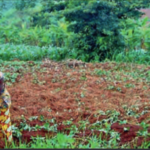
The summit (impinga) is covered with granular and porous red lateritic soil. It drains relatively quickly, probably because of its porosity rather than because of the steep slopes on each side. The summit proper offers a relatively level surface, but same of the edges bordering the pasture lands (amabanga), may incline as much as 50°and yet be cultivated.
Some run-off studies carried out by Mr. André Bodeux, Chief of the “Mission [hydrologique] du Bassin de la Karuzi”, however, have shown that erosion is far less prevalent on these cultivated slopes than had been thought in the past.
No water is found on the summit.
There is a variety of natural depressions round on the summit, at the bottom of which sometimes occurs fine white clay. These depressions seem to be found throughout this geological area.There are two such depressions on the Remera summit. They are of small size and seem to contain no clay.
The natural flora of the summit is one of Brachiaria platynota and Hyparrhenia filipendula, two tall perennial grasses. Very few wild animals are seen on impinga. Rarely, a bushbuck might come up from the valley or, at night, a serval.
Amabanga are the steep slopes on each side of a hill. In the case of Remera, they fall away on each side of the ridge and at the northern end of the bill. They form a well-defined belt around the summit. Amabanga are given principally to communal pastures, and its use as such will be discussed below under herding.
Water run-off here must be very rapid. There is very littletopsoil, and that is probably leached. Although houses are found on the less steeply pitched areas and on ledges, the bedrock is apparent and natives avoid settlement here. Every native knows that one cannot grow a banana plantation here, and that is the condition sine qua non for settlement.
No water is found on the pasture lands. It was observed, however, at least in one instance, that a very small and shallow hole about four feet square had been dug to catch the run-off from a cow path. This was near the home of a man who had one cow and who was one of the few persons who lived on the pasture lands.
Presumably, if any need for large rocks was felt, this is where they would be found. However, the first recourse of the people, and one that seems to satisfy the need for large stones, are the old abandoned homesteads, where one may always find grindstones,stones to support the granaries, and stones for the fire-place.
The natural flora of the pasture lands of Remera is one of Landtia simplex, a perennial composite, and Strigaasiatica, an annual, semi-parasitic scrophylaria.
The roads in Ruanda generally follow crests of hills and one gets the impression, when looking down into the valleys, that these valleys have streams of runningwater. Air photographs, and maps drawn therefrom, show what look like numerous tributaries and main streams; these are false impressions, however; water resources are not particularly abundant, but because of the land-locked aspect of the larger valleys, the water that does run into them drains slowly.
The lowlands (igishanga)may be divided into two parts:
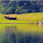
A – The swamps proper, where the ground may be soggy and is most often overgrown with papyrus in its natural state. Where the ground is drier and uncultivated, the natural vegetation is made up of sparse forests of Acacia nefasia and Acacia caffra, two species of a leguminous tree of the mimosa variety.It is in these sections that hunting takes place.
In the upper reaches of these large flat-bottom valleys, the soil may be used for agriculture. Here are located the springs, which may be used for irrigation during the dry season. In traditional times, these lands were reserved for dry season pastures and were never used for agriculture.
B -A second settlement area, on richer agricultural soils than those found on the summit. The soils, however, have their disadvantages; their high content of clay prevents them from being worked before the first rains following the dry season because when dry they are too hard to hoe. The soils of the summit, on the other hand, can be prepared and, in some cases, even seeded, before the rains.
The soil of the lower marshes, especially at the bottom, is often grey or black with a high content of clay. It is here that the potters find clay for their pots and pipes. In the eastern swamps, two enterprising persons from Remera had made bricks from the earth of the marshes. There were, also, the remnants of an old brick oven in the western marshes. It seems it had once belonged to a Mission. The ovens were made of the bricks that were to be fired.
Springs of water, which generally flow throughout the year, are found in the lowlands in area “B”. In Remera, there were two such sources for household water and two others for watering the cows. They are all at the northern extremity of Remera. These springs nearly dry up at the end of the dry season.
CLIMATE
The weather is very irregular and varies even within very small areas of Ruanda. The following figures for rainfall are based upon data gathered by the Institut National pour l’Etude Agronomique du Congo-Belge. The data for the years from 1940 to 1949 were collected at Zaza(located about ten miles as the crow files from Remera at 4970 feet above sea level; and Kibungu (about seven miles from Remera, at 5570 feet above sea level; which were close enough to Remera to be valid in indicating average rainfall. The data for 1950 to 1959 were copied only for Kibungu.
The total rainfall for the ten years between 1940 and 1950 at Zaza was 10,290 millimeters, and at Kibungu 9367 millimeters, indicating a yearly average of 1029 millimeters and 937 millimeters respectively. Remera is more likely to be similar to Kibungu than Zaza, due to geographical situation and elevation, but if we take the average of both these figures, we have 983 millimeters per year, which, obviously, is not an exact figure for Remera, but one that will be close enough. The total rainfall for the ten years between 1950 and 1959 at Kibungu averaged 969 millimeters per year.
Although the rainfall is highly irregular, it may be said that the general cyclic pattern is as follows: January is the end of the “little rainy season” and, although there is always some rain in February, it has generally diminished. This is the interval between the harvest of one crop and the planting of the next. March generally shows an increase in ran which attains a peak for the year in March and April. The month of May might still have some rain. June is the first very dry month, followed by two more. These three months may sometimes show no rain at all. September and October show sparse rainfall. Precipitation attains a “little rainy season” peak in November and December, and the cycle recommences.
https://uk.amateka.net/ii-remera-topography-and-climate/https://uk.amateka.net/wp-content/uploads/2020/05/lands.pnghttps://uk.amateka.net/wp-content/uploads/2020/05/lands-150x150.pngModel CitizenshipRemera is situated in what was in 1960 the administrative Territory of Kibungu which occupies the right angle formed by the Kagera River on the eastern border of Ruanda. Ruanda is otherwise divided into regions corresponding to the old native provinces, whose boundaries cut across those of the Territories. The...BarataBarata rpierre@ikaze.netAdministratorAMATEKA | HISTORY OF RWANDA